With the growing availability of technology and the evolution of digital tools for both museums and educators, the possibilities of digital integration are endless. Maps are one of the most widely-used forms of media and have been used for centuries to convey the meaning of place, document changes in the landscape, or explore important aspects of travel. As Richard White notes in his article, “What is Spatial History”, historians study chronology and change over time for many aspects of history, including spatial histories. By utilizing GIS (Geographic Information Systems) and other digital tools, the possibilities of studying and presenting history become endless.
While there are many digital mapping programs available, I chose to use the software Juxtapose provided by KnightLab from Northwestern University. Immediately I noticed that this web-based software seemed user-friendly and perfect for my idea of how this software can be used by museum and classroom educators alike. The software is extremely straightforward and rather simple to use, with an introductory section where the website clearly defines the capabilities of the software and even notes tips and tricks for the best outcome.
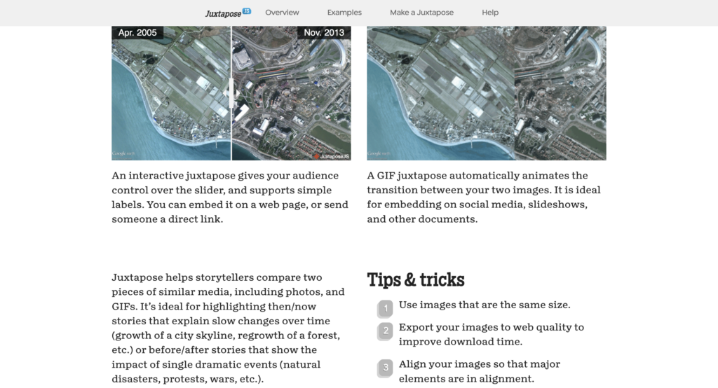
A large perk of this program, unlike other similar software, is that it does not require users to create an account or input any personal information. As for using the software, one complaint that I have is the restriction for the interactive map to either provide a live link to the images you want to use, or the requirement to use Dropbox to upload images. If your intended use does not require the map to be interactive, users can opt to use a GIF version of the software that automatically pans back and forth for you. A large perk of this version is it allows users to upload JPG images from their computers, unlike the interactive version (an example of both is provided below).
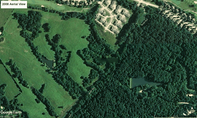
To test the software, I chose to look at the difference in the landscape on Google Earth where I recently built a home in Kentucky. As you can see on the maps, most of the land was largely greenspace in 2008(an old farm according to county records), whereas the more recent photo from 2023, shows the land being transformed into a subdivision.
While I was using the software, I noticed another large drawback in the limitations of what it can do. This software only allows for the comparison of two images with an area for labels and credit to the image provider. This software does not include any space to describe the project. Juxtapose is useful as a tool to create media for other resources, but cannot be used as a standalone product like other digital mapping software on the market.
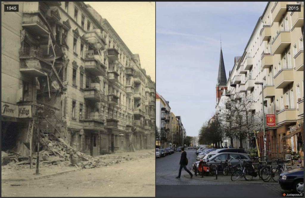
Though this software has its drawbacks, it can be useful for historians and educators to show the changes in maps of a certain region, or even before and after photographs from historic events. One such example of the capabilities of Juxtapose is shown by a collection of images on Berliner Morganpost, where the author shows the difference between images of Berlin in 1945 and 2015.
Overall, with the evolution of digital tools, many fields of study from traditional history, museums, archives, and education are changing at an exponential rate. With the creation of new technology, different aspects of historical events and places can be studied in a way like never before.
Please let me know down below what you think about this software or if you have any recommendations for others to try in the future! Thanks!
-Dakota
Hey Dakota, I found your article interesting because I used Story Map, also by KnightLab. The main thing that caught my eye was that you mention there being a tutorial for Juxtapose. I was wondering where this was located on KnightLab’s website because one of the complaints I had in my blog post was that there was no tutorial, but now I know this isn’t the case.
Hey Cole!
The tutorial area was located on the Juxtapose website. Right above where I was able to input my images was a small “how-to” section with a bunch of tips and tricks. I looked at Story Maps and they have a similar section, but its not nearly as helpful since the software is much more involved.
They really should have an in-depth tutorial.